13.5
min
Flight Time
360°
Collision Protection
4K
Inspection Camera
3D
Real-Time, LiDAR Mapping
Modular
Inspection Payloads
13.5 min
Flight Time
360°
Collision Protection
4K
Inspection Camera
3D
Real-Time, LiDAR Mapping
Modular
Inspection Payloads
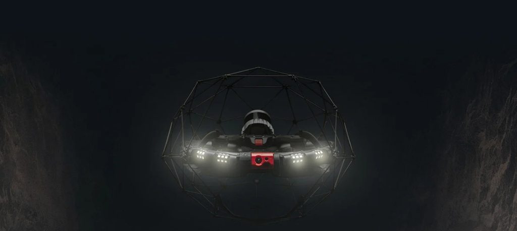
Transform The Way You Inspect And Map Industrial Assets
Industrial inspections no longer need to rely on costly shutdowns, complex access equipment or workers entering hazardous spaces. The Elios 3 enables teams to collect detailed visual and mapping data remotely, helping improve safety, reduce disruption and make faster, better-informed decisions.
Designed for challenging indoor and confined environments, it brings inspection and mapping workflows together in one adaptable platform.
Capture More Than Images WIth Intelligent Inspection Data
Combining computer vision, LiDAR mapping and real-time localisation, the Elios 3 helps teams inspect complex indoor environments with greater confidence. Operators can navigate using a live 3D model of the asset while collecting visual and spatial data that supports clearer reporting and more informed maintenance decisions.
Advanced Mapping And Inspection Technology
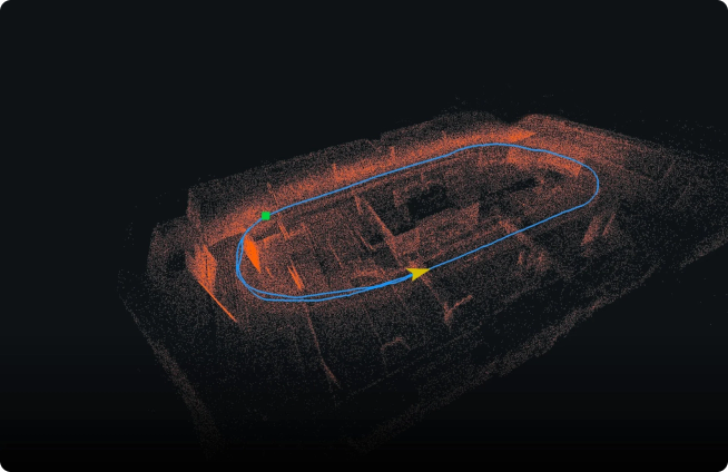
Real-Time 3D Mapping
The FlyAware™ SLAM Engine combines LiDAR, computer vision and onboard processing to map the surrounding environment as the Elios 3 flies. This gives operators a live 3D view of the asset, helping them understand the drone’s position and confidently navigate complex, GPS-denied spaces.
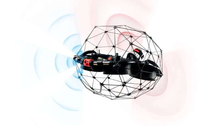
Stable Flight in Confined Spaces
SLAM-based stabilisation helps the Elios 3 maintain its position by continuously analysing its surroundings and adjusting for movement. This makes the aircraft easier to control in tight, dark or challenging environments where GPS and traditional positioning systems are unavailable.
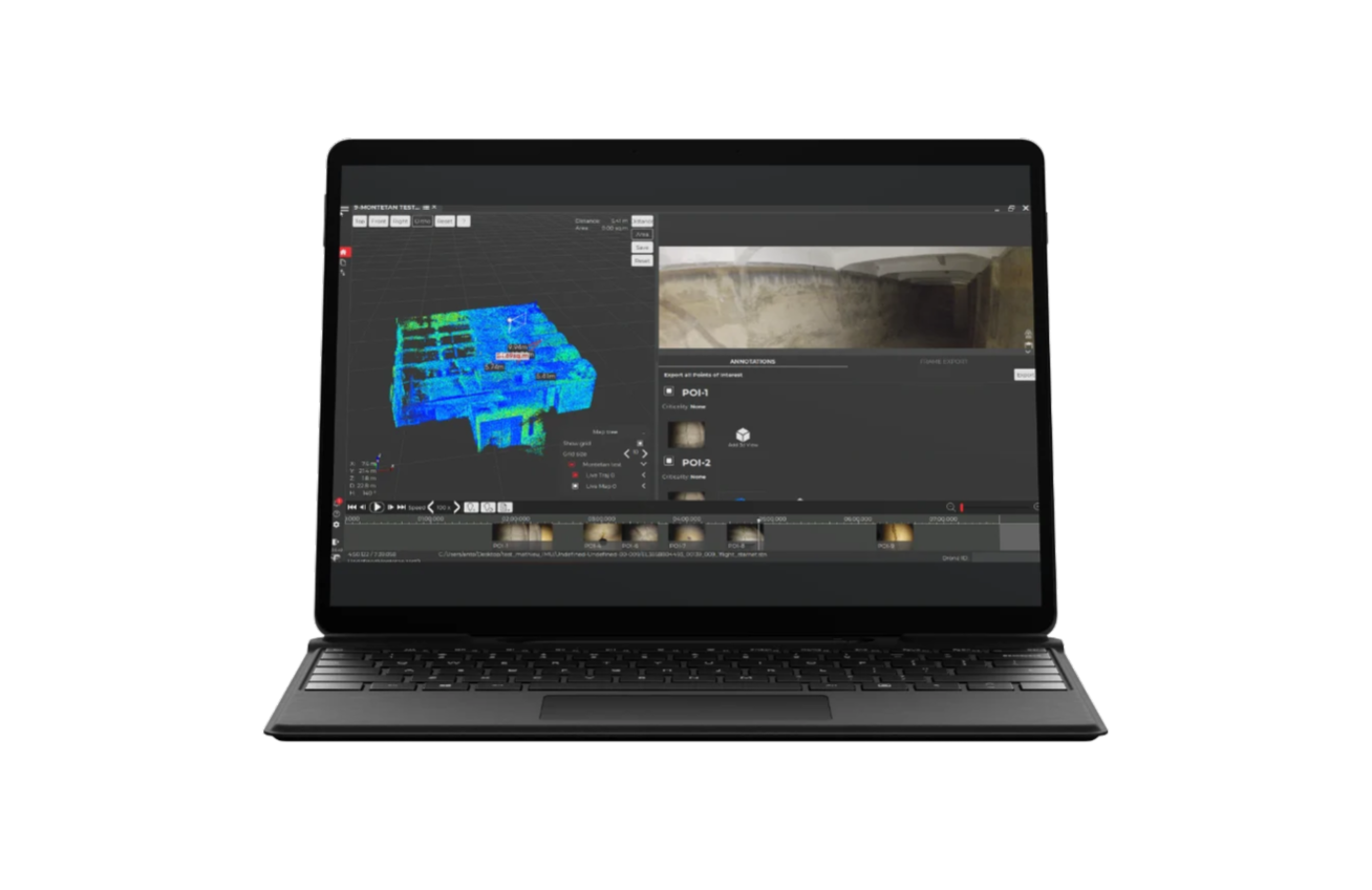
Streamlined Inspection Reporting
Inspector software brings visual footage and 3D inspection data together in one workspace. Teams can review findings, locate points of interest within the asset and create clearer reports that support faster maintenance and operational decisions.
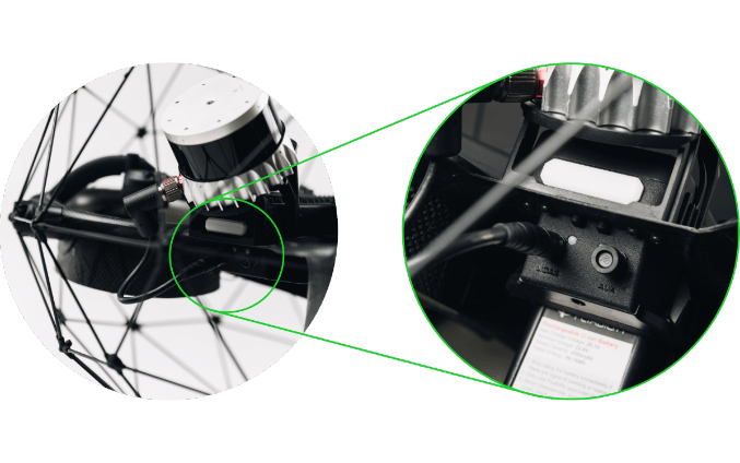
Adaptable Payload Options
The modular payload bay includes dedicated connections for LiDAR and additional inspection sensors. This allows the Elios 3 to be configured for applications such as detailed surveying, radiation detection and ultrasonic thickness measurement.
Live 3D Mapping
The Elios 3 uses onboard LiDAR to scan its surroundings and generate a live point cloud as it flies. Displayed directly within the Cockpit app, this real-time 3D view helps operators understand the drone’s position, monitor its flight path and navigate complex environments with greater confidence.
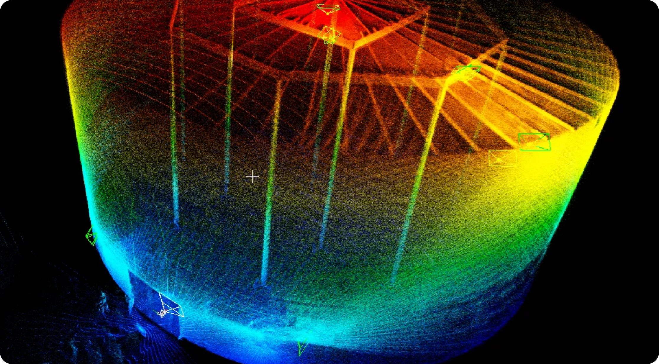
Maintain Positional Awareness
See the drone’s location within the developing map, helping pilots make safer decisions and return confidently through confined spaces.
Monitor Inspection Coverage
Review the mapped area during flight to identify gaps and confirm that all required parts of the asset have been inspected.
Return-To-Signal
Stay In Control When Signal Becomes Limited
The Elios 3 is designed to help maintain safe operation in environments where radio connectivity may be affected. If the video feed is interrupted, the drone can autonomously retrace its flight path until the connection is restored, giving pilots added confidence when inspecting complex structures.
Collison-Resilient Rugged Design
Built For Challenging Industrial Environments
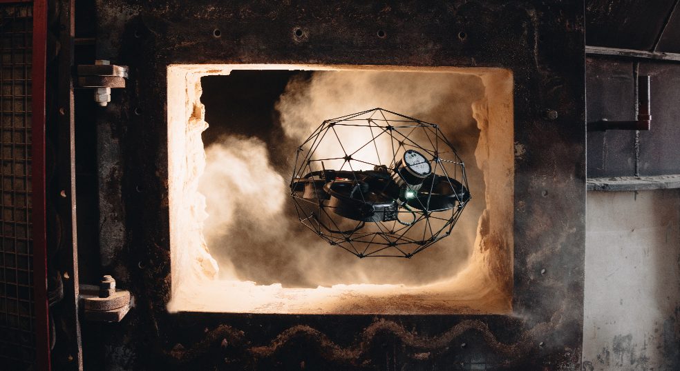
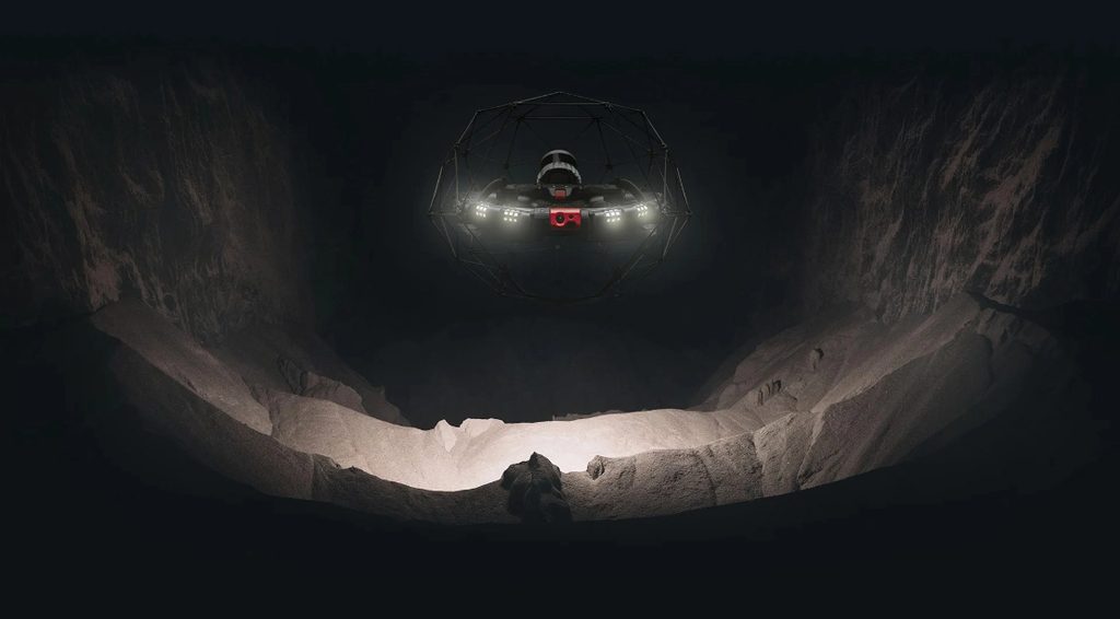
The Elios 3 features a collision-tolerant protective cage that allows it to make contact with obstacles while remaining stable in flight. Combined with its rugged IP44-rated design, it is built to inspect confined, dusty and demanding environments where conventional drones simply can’t operate reliably.
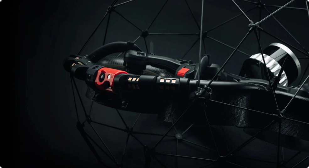
Close-Up Inspection Payload
Capture detailed visual data in confined and hard-to-reach spaces with the Elios 3 inspection payload. Combining a 4K camera, thermal imaging, distance sensing and powerful lighting, it helps operators identify defects such as corrosion, cracks and material build-up with greater clarity and consistency.
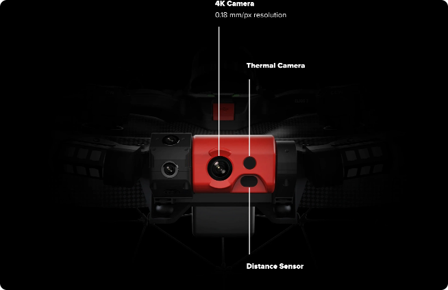
4K Inspection Camera
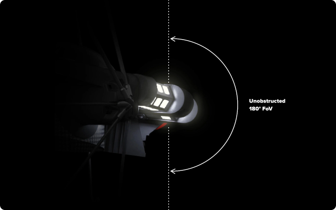
Unobstructed 180° Field of View
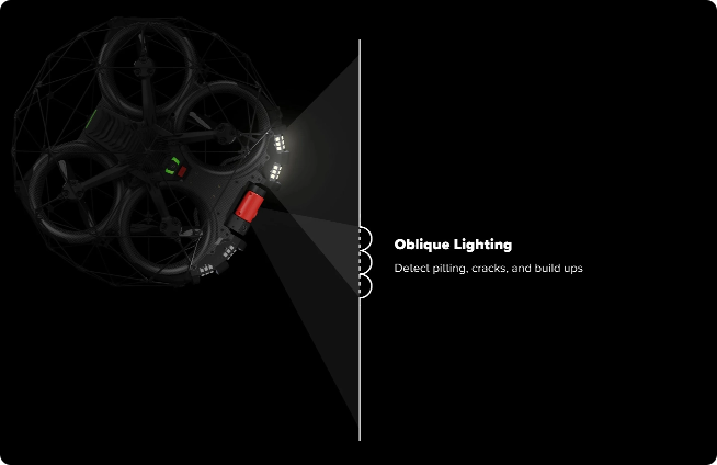
Targeted Oblique Lighting
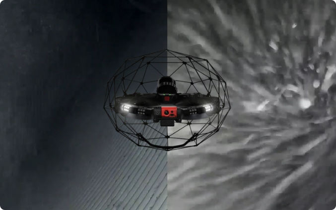
Adaptive Lighting System
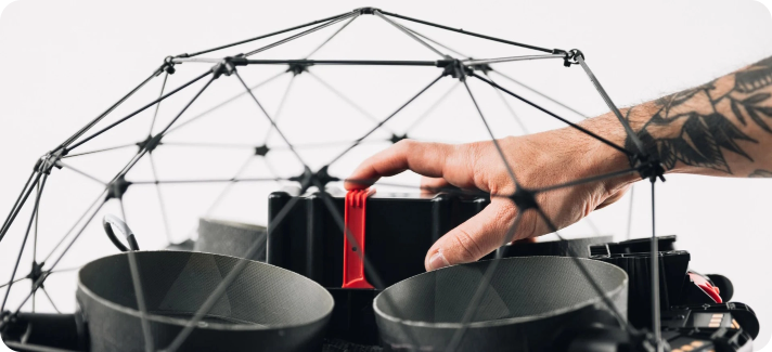
Longer Flight Time
Combining computer vision, LiDAR mapping and real-time localisation, the Elios 3 helps teams inspect complex indoor environments with greater confidence. Operators can navigate using a live 3D model of the asset while collecting visual and spatial data that supports clearer reporting and more informed maintenance decisions.
Expand the Capabilities of Your Elios 3
Adapt the Elios 3 to different inspection requirements with specialist power solutions and payloads. From longer missions to remote ultrasonic thickness measurements, these additions extend what your Elios 3 can achieve in the field.
Tether Power Unit
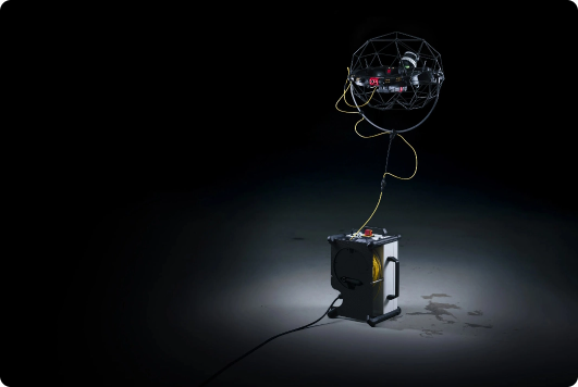
Remove conventional battery limitations with the Elios 3 Tether Power Unit. Connected to a mains supply, generator or compatible portable power station, the system delivers continuous power through a 50-metre Kevlar-reinforced tether, allowing operators to stay focused on longer inspection missions without stopping for battery changes.
High-Capacity Battery
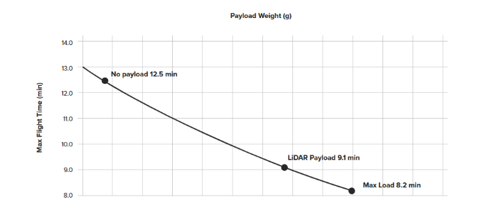
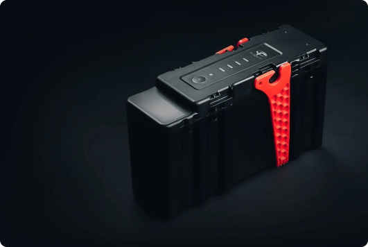
Extend your time in the air with the Elios 3 High-Capacity Battery. Delivering up to 17 minutes of flight time and up to 50% more flight time per charge, it helps teams inspect more of an asset before returning for a battery change.
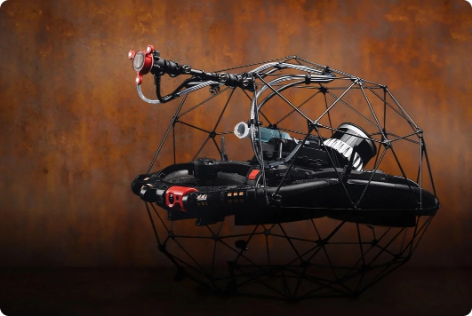
Elios 3 UT Payload
Transform the Elios 3 into a remote ultrasonic thickness measurement platform. Developed with Cygnus Instruments, the UT Payload enables teams to capture thickness readings and high-resolution A-scans in elevated, confined and difficult-to-access locations while keeping operators safely away from the inspection area.
Frequently Asked Questions
The Elios 3 is purpose-built for non-line-of-sight (NLOS), GPS-denied, and hostile industrial environments. It features a collision-resilient carbon-fibre cage mounted on a decoupling mechanism that absorbs impacts up to 3 m/s, paired with motor-reversing logic that prevents prop-stalling upon contact. Navigation relies on Flyability’s proprietary SLAM (Simultaneous Localisation and Mapping) engine powered by an onboard LiDAR, allowing sub-centimetre position hold and obstacle clearance without satellite signal, external lighting, or air currents destabilising the flight.
The Elios 3 uses high-penetration digital transmission alongside an optional long-range range extender and physical tether system for deep-tunnel or thick-wall assets. In the event of video or command link degradation, the drone activates an intelligent Return-to-Signal feature: the Cockpit app prompts the drone to autonomously retrace its exact flight trajectory along the onboard SLAM map until the radio link is re-established or initiates a controlled landing if the link cannot be recovered.
The Elios 3 achieves up to 12 minutes of flight time in its base inspection configuration (integrated 4K visual sensor, FLIR radiometric thermal camera, and 16,000-lumen oblique dustproof lighting). When operating with modular external payloads—such as the Surveying LiDAR payload or Ultrasonic Thickness (UT) gauge—flight time typically ranges between 9 and 10 minutes per smart battery pack. Batteries are hot-swappable to maintain continuous site rotation.
The Elios 3 features a dual-payload integration bay designed for multi-sensor data harvesting:
- Surveying Payload: Equipped with an Ouster LiDAR sensor for high-density, survey-grade 3D point cloud generation.
- Ultrasonic Thickness (UT) Sensor: Equipped with a couplant dispenser and remote probe head to measure steel wall thickness and detect internal corrosion without human entry.
- Radiation Detection Sensor (RAD): Designed for nuclear facility surveillance and hazardous material response.
Field operators receive real-time 3D situational point clouds streamed directly to the Flyability Cockpit tablet during flight. Post-flight, data is processed through Flyability Inspector and compatible SLAM engines to output dense georeferenced point clouds (E57, LAS, PLY), high-resolution photogrammetric orthomosaics, and radiometric thermal maps. These integrate seamlessly into CAD, BIM (Autodesk Revit, Navisworks), and digital twin platforms like Trendspek and Asset Management Software.
For commercial operation in the UK, pilots must hold an appropriate CAA qualification (such as an A2 CofC, GVC, or RPC-L1 under the UK SORA framework depending on operational airspace and risk parameters). Coptrz Academy delivers manufacturer-certified Flyability Elios 3 Model-Specific Training, covering system calibration, SLAM troubleshooting, caged flight dynamics, and payload-specific workflows.
Trusted Where Failure Is Not An Option

Nick Canham
Duncan Turner
Adam Carter
Emily B.

Partners & Clients










Need Help Choosing The Right Elios 3 Setup?
Speak to a Coptrz expert about payloads, software, training and support. We’re on hand to help you configure the right LiDAR solution for your team, your missions, and your budget.
Accreditations
Recognised for excellence. Explore the industry certifications that validate our commitment to quality, compliance, and continuous improvement.

ISO 9001 Certified
Certified quality management systems for consistent service and customer satisfaction.

ISO 14001 Certified
Internationally recognised standard for environmental management and commitment to sustainable operations.

Cyber Essentials & Cyber Essential Plus
Government-backed certification demonstrating the highest level of commitment to robust cyber security.

The Equality Register Member
Committed to promoting equality, diversity, and inclusive practices across our entire organisation.

TQUK Recognised Centre
An officially recognised centre for Training Qualifications UK, delivering high-standard regulated qualifications

Registered with Elcas
Approved by the Enhanced Learning Credits Administration Service to provide funded training for Armed Forces personnel.

UK CAA Recognised Assessment Entity: RAE15510
CAA-approved to deliver drone training and assessment for RPC-L1, GVC and A2 CofC qualifications.

FCA Registered
Authorised and regulated by the FCA for consumer finance activities.
UK SORA & BVLOS Operations: SORA-28947, SORA-29134
Helping organisations obtain Operational Authorisations for BVLOS and other complex drone operations using the UK SORA framework.

Ofqual Regulated Training
Delivering prestigious, government-regulated training programmes that guarantee educational excellence and industry recognition.
Latest From Coptrz

Transforming UK Agriculture & Forestry with Advanced Drone Solutions

Elevating Public Safety: How Drones Are Transforming Emergency Response

DJI Matrice 400



