Drones
Browse our wide range of commercial drones for sale, engineered to deliver exceptional data accuracy and mission reliability. From high-precision drone surveying systems to advanced industrial thermal imaging drones, find the exact enterprise platform to scale your business operations.
-

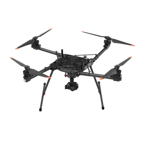
Alta X
ALTA X is designed to satisfy the needs of professional and industrial partners. We designed the ALTA X from the ground up to achieve the perfect blend of efficiency, agility, and reliability while keeping the pilot workflow simple and fast. ALTA X builds on the experience and lessons we learned bringing ALTA 6 and 8 to the world.
-

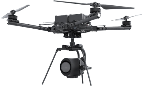
Alta X Gen2
The next evolution in Freefly flight is here! Alta X Gen2 combines the rugged, heavy-lift performance of the Alta X airframe with the cutting-edge flight controller, smart payload interfaces, and seamless workflow integration of Astro Max.
-

Anzu Raptor
£4,997.00 Excl. VATOffering robust features in a compact solution, Anzu Raptor is suited for a wide variety of commercial applications. Mapping and other missions can be carried out with ease, with Raptor offering up to a 45-minute flight time.
-
Anzu Raptor T
£6,997.00 Excl. VATFor thermal missions that require portability and efficiency, Anzu Raptor T is the right tool and is suited for a wide variety of commercial applications. From inspection to search & rescue, operations can be carried out with ease. Raptor T offers up to a 45-minute flight time, allowing you ample time to complete your mission.
-

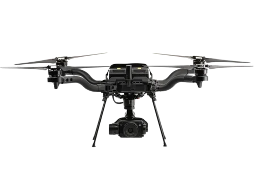
Astro
Astro is a compact, high‑performance industrial drone designed for enterprise data capture. Built by Freefly Systems, Astro combines robust flight performance, modular payload support, and seamless integration with professional mapping and inspection workflows.
-
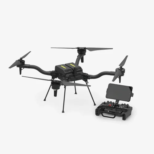
Astro Max
The Astro Max is Freefly’s most advanced compact industrial drone, engineered to deliver a perfect blend of efficiency, agility, and reliability. Built on the success of the Alta family, the Astro Max is designed from the ground up to empower professional and industrial partners with a flexible, high-performance aerial platform.
-

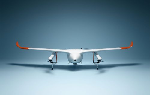
Avy Aera
The Avy Aera is a robust, fixed-wing VTOL system designed to bridge the gap between drone versatility and aircraft efficiency. By taking off vertically like a helicopter and transitioning into winged flight, it leverages the best of both worlds for superior performance.
-

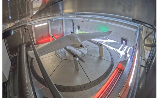
Avy Dock
The Avy Dock is more than just a hangar; it is the critical infrastructure that transforms the Aera into a fully remote, "drone-in-a-box" system. By automating the most labor-intensive parts of drone flight—launching, landing, and charging—the Dock enables continuous aerial coverage without anyone on-site.
-
DJI Air 3
Price range: £801.67 through £1,149.17 Excl. VATThe DJI Air 3 is a highly-anticipated drone featuring a dual camera system, 46-minute flight time, and improved video transmission technology. It offers a range of intelligent flight features, including FocusTrack, QuickShots, and MasterShots, for an enhanced aerial photography experience.
-
DJI Air 3S
Price range: £6,816.00 through £8,875.00 Excl. VATDual-Camera Drone For Travel Photography
- Dual-Camera 4K/60fps HDR Video & 14 Stops of Dynamic Range
- Nightscape Omnidirectional Obstacle Sensing
- 45-Min Flight Time, 20km Video Transmission
- 1″ CMOS Primary Camera
- Next-Gen Smart RTH With Enhanced Precision
- Free Panorama, Seamless & Detailed
-
DJI Avata 2
Price range: £6,816.00 through £8,875.00 Excl. VATImmersive, Cinematic FPV Drone For Hassle-Free POV Content
- Immersive FPV Flight Experience
- Tight Shots in Super-Wide 4K
- Intuitive Motion Control
- Built-In Propeller Guard
- Easy ACRO
- Hassle-Free POV Content
-
DJI Dock 2
Price range: £131.67 through £5,766.67 Excl. VATThe DJI Dock 2 is a compact, powerful drone hangar designed for autonomous operations, effortlessly deploying either the Matrice 3D or 3TD drones. It supports third-party payloads, enabling versatile operations.